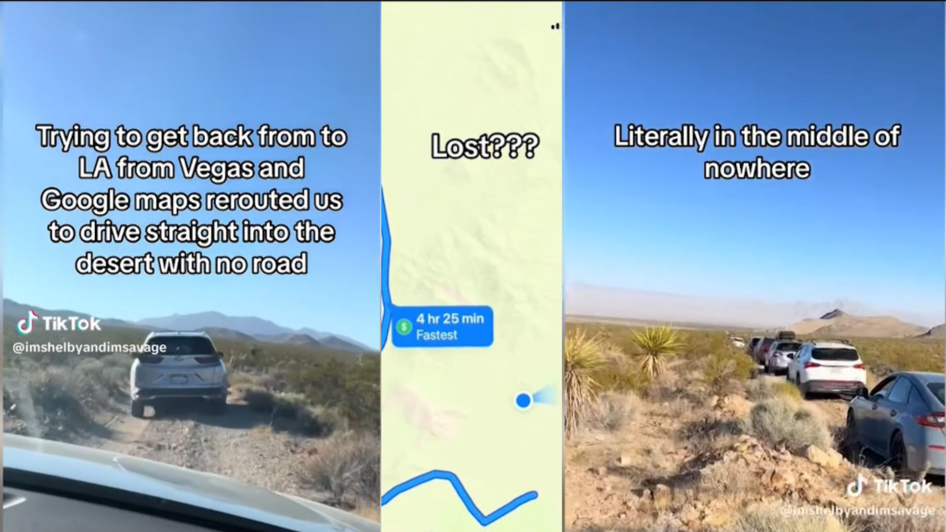
Formula 1’s inaugural Las Vegas Grand Prix produced a navigation fiasco when a significant number of fans departing the event found themselves following Google Maps directions onto unpaved desert roads, leaving vehicles stranded far from any paved route back to the city.
What Happened
Post-event traffic congestion around the Las Vegas Strip prompted many fans to rely on navigation apps to find alternate routes. Google Maps, responding to real-time traffic data, routed a portion of users onto roads that were either unpaved, unmaintained, or simply not suitable for standard passenger vehicles. The result was a column of cars and SUVs stuck in the Nevada desert in the early morning hours after the race concluded.
The App’s Role
Navigation app routing errors during major events have become a recurring problem as traffic management systems and GPS mapping data fail to account for the specific conditions created by large crowds departing simultaneously. Google Maps optimizes for travel time based on available data, but that data doesn’t always include road surface quality or the practical limitations of what a standard rental car can handle.
Broader Event Planning Questions
The incident raised questions about whether Formula 1 and Las Vegas event planners had adequately coordinated with local traffic authorities to prevent exactly this kind of outcome. Major events that draw hundreds of thousands of attendees require traffic egress planning that goes beyond what navigation apps can provide, including active traffic management and clear communication to attendees about which routes are and aren’t suitable.